
Who We Are
"At Mapmatica Geo Solutions, we don’t just provide geospatial services—we empower your vision with precision and purpose. Driven by innovation and backed by a team of forward-thinkers, we harness the power of cutting-edge technology to unlock new possibilities in mapping, LIDAR, and data analytics. Whether shaping the cities of tomorrow, safeguarding natural landscapes, or driving infrastructure growth, we are committed to delivering results that elevate every project to its highest potential."

Our Services
-
LiDaR
-
Mobile Laser Scanning
-
Digital Photogammetry
-
Terrestrial Laser Scanning
-
Ortho Photography
-
Drone Survey Solution
-
Total Station and DGPS Survey
-
GIS Data Transformation
LiDaR - Light Detection and Ranging
Airborne Lidar:
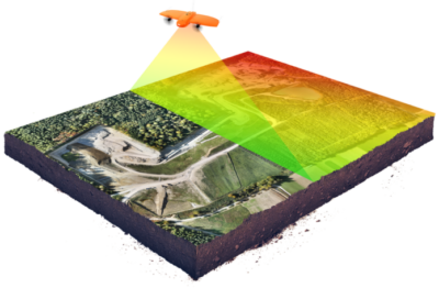
We provide Airborne LiDAR services to offer highly accurate and high-resolution 3D mapping. With advanced laser technology, our airborne systems efficiently scan large areas in a short time. This detailed data is crucial for industries such as urban planning, infrastructure development, forestry, and environmental management..
Unmatched Accuracy: Capture terrain and structural details with centimeter-level precision, even in dense vegetation or hard-to-reach locations.
Faster Data Collection: Cover vast areas in a fraction of the time compared to traditional surveying methods.
Versatile Applications: From topographic mapping to infrastructure management, LiDAR adapts to your project’s unique needs.Ideal for mapping cityscapes, monitoring coastal erosion, managing forest inventory, or even planning large-scale construction projects.
Mobile Laser Scanning
Mobile Laser Scanning: we offer Mobile Laser Scanning services to provide high-resolution 3D mapping of roads, infrastructure, and urban environments. Using state-of-the-art laser technology mounted on mobile platforms, we can rapidly scan extensive areas while on the move, delivering precise and detailed data for various industries.
Unparalleledc Accuracy: Capture every detail of road networks, bridges, and buildings with centimeter-level precision, even in fast-changing environments.
Effecient Data Collection : Scan large areas quickly, minimizing disruption and project downtime, making it ideal for urban settings and infrastructure projects.
Wide-Ranging Applications: Perfect for road condition assessments, construction monitoring, asset management, and urban planning.
Digital Photogrammetry
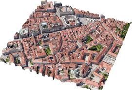
Digital Photogrammetry: Using advanced imaging techniques, we transform 2D photographs into precise, measurable 3D data, providing essential information for industries like construction, surveying, and environmental monitoring.
Accurate 3D Models: Generate highly detailed and precise 3D representations of landscapes, buildings, and infrastructure.
Cost-Effective Solutions: Capture large areas and complex structures efficiently, reducing the need for extensive ground-based surveys.
Flexible Applications: Ideal for topographic mapping, site monitoring, volumetric calculations, and urban planning.
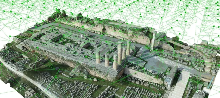
TSL - Terrestrial Laser Scanning
TSL: we offer Terrestrial Laser Scanning services to deliver highly accurate, detailed 3D data of structures, landscapes, and environments from ground-level.Creating a comprehensive digital model essential for industries like construction, heritage preservation, and engineering.
High-Resolution Detail: Capture fine details of buildings, terrain, and objects with millimeter-level accuracy, ideal for complex projects.
Efficient Data Collection: Rapidly scan and document structures, minimizing time on-site and ensuring comprehensive coverage of intricate environments.
Versatile Applications: Perfect for building documentation, structural analysis, volumetric calculations, and historical site preservation.
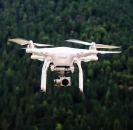
ORTHO - Photography
ORTHO: we offer Ortho Photography services to provide high-resolution, we create orthorectified photographs that accurately represent the surface, making them essential for detailed mapping, urban planning, and property analysis.
High-Resolution Imagery: Obtain clear, detailed aerial views with accurate spatial information, perfect for analyzing landscapes and structures.
Precise Measurements: Get distortion-free images where measurements and spatial relationships are accurate, supporting precise planning and analysis.
Wide-Ranging Uses: Ideal for creating detailed maps, assessing property developments, and conducting urban and environmental studies.
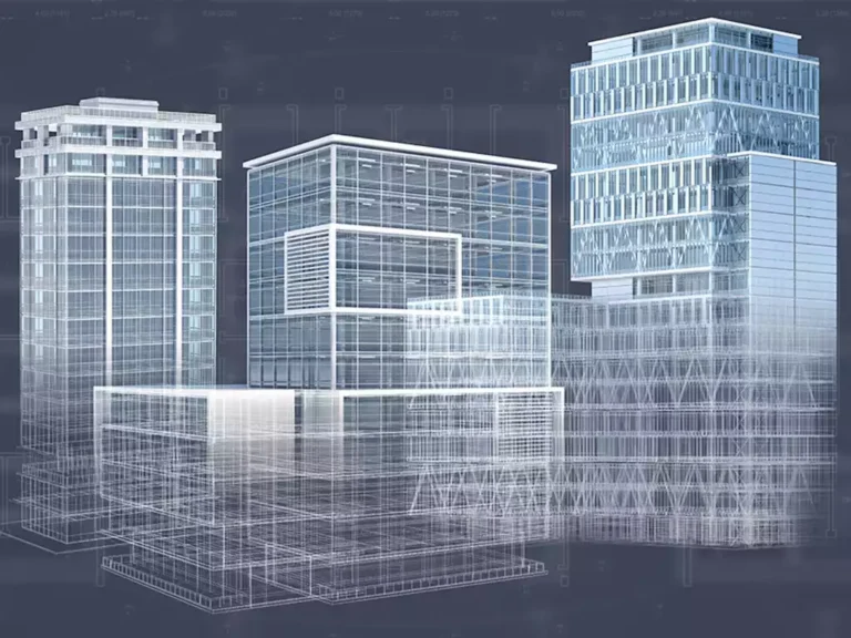
DRONE - Survey Solution
Drone Survey Solutions: we offer Drone Survey Solutions to deliver precise, high-resolution aerial surveys with exceptional efficiency
Enhanced Precision: Capture high-quality, accurate aerial data with detailed views of large areas and intricate features.
Efficient Data Collection: Quickly survey extensive sites, reducing the time and cost associated with traditional survey methods.
Versatile Applications: Ideal for mapping topography, inspecting structures, monitoring environmental changes, and managing large-scale projects.

Total - Station and DGPS Survey
Total Station and DGPS Survey:
Utilizing state-of-the-art total stations and Differential GPS (DGPS) technology, we capture precise spatial information crucial for surveying, construction, and infrastructure development.
Exceptional Accuracy: Achieve precise measurements with high accuracy, essential for detailed mapping and construction planning.
Efficient Surveying: Quickly collect accurate data across large sites, streamlining the survey process and reducing project timelines.
Broad Applications: Perfect for land surveys, construction layout, boundary determination, and infrastructure monitoring.

GIS - Data Transformation.
GIS – Data Transformation :we offer GIS Data Transformation services to ensure your spatial data is accurately converted and integrated across various GIS platforms. We transform GIS data to meet your specific requirements, enabling seamless integration and improved data usability.
Accurate Data Conversion: Efficiently convert data between different GIS formats, ensuring compatibility and preserving data integrity.
Enhanced Integration: Transform data to integrate seamlessly into your GIS system, improving functionality and accessibility.
Versatile Solutions: Ideal for updating datasets, migrating to new systems, and aligning data with project-specific requirements.

Default Funfact Style
Happy Customers
Project Complete
Registered Member
Awards Winning
Clients Say
Testimonials
A small river named Duden flows by their place and supplies it with the necessary regelialia. It is a paradise
About our clients
A small river named Duden flows by their place and supplies it with the necessary regelialia.
Behind the word mountains, far from the countries Vokalia and Consonantia, there live the blind texts. Separated they live in Bookmarks
Our Resources
ORTHO - Photography
ORTHO: we offer Ortho Photography services to provide high-resolution, we create orthorectified photographs that accurately represent the surface, making them essential for detailed mapping, urban planning, and property analysis.
High-Resolution Imagery: Obtain clear, detailed aerial views with accurate spatial information, perfect for analyzing landscapes and structures.
Precise Measurements: Get distortion-free images where measurements and spatial relationships are accurate, supporting precise planning and analysis.
Wide-Ranging Uses: Ideal for creating detailed maps, assessing property developments, and conducting urban and environmental studies.

Far far away, behind the word mountains, far fro
m the countries Vokalia and Consonantia, there live the blind texts. Separated they live in Bookmarksgrove right at the coast.

Far far away, behind the word mountains, far fro
m the countries Vokalia and Consonantia, there live the blind texts. Separated they live in Bookmarksgrove right at the coast.

Far far away, behind the word mountains, far fro
m the countries Vokalia and Consonantia, there live the blind texts. Separated they live in Bookmarksgrove right at the coast.

Far far away, behind the word mountains, far fro
m the countries Vokalia and Consonantia, there live the blind texts. Separated they live in Bookmarksgrove right at the coast.
Industries We serve

Construction
Enhancing project planning and execution with accurate spatial data.

Infrastructure
Supporting the development and maintenance of critical infrastructure.

Environmental Management
Providing data for environmental assessments and conservation efforts.

Urban Planning
Aiding in the planning and development of sustainable urban environments.

Oil and Gas
Offering precise data for exploration, production, and pipeline management.

Mining
Delivering detailed geological mapping and resource management.
